After one night in Anchorage (on my second time through town) I started the drive to Wrangell St. Elias National Park. It’s only a couple hundred miles, but it takes a while because 60 miles are on a nasty gravel road. I didn’t really know what I was going to do in the park. I knew I was going backpacking, and I had a few ideas of places I wanted to go, but I wasn’t sure where to go, so I stopped in the park visitor center. An extremely nice ranger helped me plan my trip. I originially did not plan to fly into the park because of the cost. (It’s especially expensive for one person travelling alone because you have to pay for the whole plane.) So I had planned to hike in somewhere from the road. But the ranger called one of the air taxi services and helped me figure out an itinerary that revolved around flights they were already making for other groups, which brought the price down substantially. The ranger convinced me the only way to really visit the park is to fly in, so that’s what I did! The next morning, I went to the airstrip near McCarthy, met my pilot, and took off, bound for an airstrip near Wolverine Mountain.

The plane. A Piper Cub 160.
A few shots from the flight in:


Looking over the pilot’s shoulder as we approached the airstrip. (Yup, that’s all it is, a nice flat stretch of grass.)
The pilot dropped me off, picked up a couple that had spent a few nights there, and he was on his way.

There they go. I guess I’m on my own. (This trip is definitely taking it up a notch when it comes to being “out there.” I’ve hiked into some fairly remote areas, but I’ve never flown in to a hike before.)
From here I hiked to the Doubtful Creek airstrip. As the crow flies it’s only about 8 miles. The hiking route, however, cuts around a few mountains, so it’s almost 20 miles. I was dropped off on a Friday morning, and was getting picked up on a Monday morning, so I had 3 days to hike. The hiking was pretty strenuous--lots of up and down, thrashing through brush, crossing scree slopes, et cetera, but I didn’t have that much distance to cover, so it wasn’t bad.
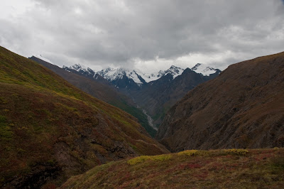
Unfortunately the weather wasn’t great. It rained a lot. It was never a heavy rain, but there was a light, stead rain for much of the trip. This also meant visibility was pretty lousy.
A bunch of pictures from the hike follow.

If asked to guess what state this was in, I probably would have guessed Utah long before I guessed Alaska.


One of many small waterfalls.

Look! Blue skies! Unfortunately they didn’t last.


Ice near the terminus of the Nizina Glacier. Like almost all glaciers, it's retreating and it’s left these big chunks behind.


The Doubtful Creek "airstrip," where I was to be picked up. It's not on the map, and I didn’t know the exact location. My pilot gave me a general idea, but I still had to wander around for a while before I found it. From the air it’s pretty easy to spot, but from the ground it’s easy to miss.

The fog was pretty thick on Monday morning, so I was a bit worried that my pilot wouldn’t be able to pick me up. I had extra food, so it wouldn’t have been a big deal. But I was ready to go, so I was glad when I saw the plane.

They brought the big plane this time. He dropped off a group of three who were in for a day hike and took me back to McCarthy.
A few pics from the flight back:

The Nizina Glacier, from the air.


I believe that’s the Nizina River.


Approaching the McCarthy airstrip. At least this looks like an airstrip. (It is gravel, though.) Glad to be back on the ground. (I'd be lying if I said small planes and bush landings don't make me nervous.) What a trip!
Anyway, that’s all for Wrangell St. Elias. I’m in Valdez right now, spending this rainy, foggy day at the library.
No comments:
Post a Comment